We set out to hike from the Mecca Hills, near Salton Sea up to Last Chance Mountain, at the very northern edge of Death Valley National Park, a journey of over 500 miles, entirely self-supplied. The hike was mostly overland, with the occasional dirt road remnant from days gone by. Because you're wondering, we saw 4 snakes, tons of tarantulas, and 1 scorpion. We saw wild burros, coyote, kit fox, bighorn sheep, mule deer, kangaroo rats, lizards, ravens, hawks, jackrabbits and cottontails, and many different birds and bugs.
The desert is known for its skies, and it didn't disappoint. Sunrises, sunsets, stars, crazy cloudscapes, etc. were spectacular. Mojave National Preserve and Death Valley National Park were definitely highlights in their scale, variety, and undeniable beauty, from starkness to intricate succulent gardens, from windswept dunes, to brilliantly colored canyons laden with veins of ore.
The desert is known for its skies, and it didn't disappoint. Sunrises, sunsets, stars, crazy cloudscapes, etc. were spectacular. Mojave National Preserve and Death Valley National Park were definitely highlights in their scale, variety, and undeniable beauty, from starkness to intricate succulent gardens, from windswept dunes, to brilliantly colored canyons laden with veins of ore.
 |
| It's not an official trail, but we can make it look that way by standing at a BLM map kiosk! |
 |
| Hoo-ah, it's happening! We are going for a walk in the desert-- cannot find ourselves on the map within 20 minutes of leaving the road. This is gonna be good. |
 |
| Still in search of the route we found a nice steep 750-foot face to climb |
 |
| Finally up on the ridgeline of Orocopia Mountain, with Salton Sea (and Slab City) in the background. |
 |
| Hydration... we had about a 5 gallon carry capacity, and used it. |
 |
| continuing with my series of out-of-focus pictures of pastries and mountain vistas... |
 |
| yeah, we have some food and tequila buried riiiiiiight abooooout here. |
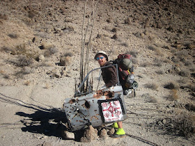 |
| I brought along this car door so if I got too hot, I could roll down the window |
 |
| wiped out in the only shade for miles. |
 |
| waiiit, what's underneath that old head gasket? |
 |
| CANDY!!!!! |
 |
| first in a series of Sherman reflecting floral expressions. OCOTILLO!! |
 |
| Sunrise in Joshua Tree NP |
 |
| Fan palm oasis is welcome shade, but full of snakes and tarantulas, FYI |
 |
| desert bighorn |
 |
| i never get tired of seeing these little cacti, bursting from the rock in hot pink "elbows out" style |
 |
| using your fleece pullover as pants is a classic move in the art of "cozification." note taped toes |
 |
| getting an education on orienteering |
 |
| come out with you paws up! burrows are EVERYWHERE out here, making a cool and humid, shady spot. we always wondered who lived in each one. |
 |
| this is what mistletoe does to a tree |
 |
| welcome shade in Joshua Tree |
 |
| emerging from the bushes with a food cache and 6 gallons of h2o. |
 |
| Abandoned rail line to Eagle Mountain Iron Mine |
 |
| blister popping and taping time |
 |
| tomorrows destination: Coxcomb Mtns. |
 |
| tracks of visitors to the dried up watering hole |
 |
| migrating butterflies pass through Joshua Tree on their way to Morelia, Mexico |
 |
| many climbs had the same pattern, which was sand, brambles, boulders, cacti, summit. |
 |
| find sherman |
 |
| the Coxcombs are definitely Joshua Tree's best kept secret. |
 |
| in between the mountain ranges are wide open valleys, with 10-40 miles of sand, rocks, and the resilient creosote bush. |
 |
| these sandy places are home to the kangaroo rat, which digs burrows that you can collapse into over and over again. |
 |
| despite how featureless it looks from the window of an airplane or car, the desert floor is perpetually changing. this section was covered in pebbly remnants of a volcanic blast. |
 |
| creosote flats, in front of a freight train, in front of the marble mountains, in front of the providence mountains. -- a week's work lay before us. |
 |
| it keeps going |
 |
| and going |
 |
| to the rails at last, after hearing them rumble through the desert silence over the last 30 miles |
 |
| an old tricycle, mangled by a train and left to die |
 |
| this would be fun to resuscitate! |
 |
| getting our kicks on route 66 |
 |
| after miles and miles of creosote bushes, one blue bush stood out, and 15 feet away was buried our cache... |
 |
| found this note in a glass jar on top of a lonely peak in the trilobite wilderness. he's probably well into the 600s by now. There's 756 for those of you scoring at home. |
 |
| not too many snakes out at this time of year |
 |
| these Arkansan ladies were walking coast to coast on a 3800 mile route. Only 8 days from completion. |
 |
| we crossed paths at an I-40 underpass. just 2 ladies with a stroller, walking through the desert... and i thought unicyclists got strange looks from motorists! |
 |
| this cache was marked by a yucca stump |
 |
| luckily this trap was too rusty to be dangerous. |
 |
| more floral impersonations |
 |
| where's matt? |
 |
| i think this moth was trying to mate with my gaiters |
 |
| the nice thing about getting stabbed with cholla is that the spines are strong enough that they don't break off when you pull them out |
 |
| upside down tree in the granite mountains |
 |
| pinyon pine sunset at 5800 feet |
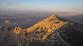 |
| Granite Mountains in Mohave National Preserve |
 |
| our first look at the Kelso dunes |
 |
| hidey camp spot nestled in the rocks |
 |
| Bull Canyon was so brushy and cliffy it took about 10 hours to go 5 miles. |
 |
| quartz veins |
 |
| any canyon with springs is bound to have lush vegetation |
 |
| finally, an excuse to use the p-cord we brought |
 |
| diggin up dinner |
 |
| the largest creosote bush ever. |
 |
| demonstrating proper technique for standing up with your pack already on |
 |
| the wind and black sand made some nice patterns in the sand |
 |
| dirt tattoo! just add dirt, then wipe away! |
 |
| Kelso Depot is a restored Union Pacific whistle stop and now park service visitor center and museum. good place to chill out and wave to passing train riders |
 |
| horseshoe mesa |
 |
| hole-in-the-wall |
 |
| these rings were handy |
 |
| foot bath at the campground |
 |
| we watched this fearless bunny hop around and munch leaves for about 10 minutes. we had to leave before death by cuteness |
 |
| hollow tree |
 |
| once upon a time, the mojave road linked crucial watering holes and springs in a path from the Colorado River to the San Bernadino Mountains. now a graded dirt road is a relative highway |
 |
| joshua tree impersonation |
 |
| lunch on the porch of an old mine / homestead |
 |
| old conveyor belt was still in place |
 |
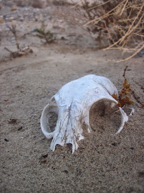
| we didn't see any tortoises, but they are normally hiding in their burrows this time of year. lots of carapaces though |
 |
| caught in the act!!! |
 |
| old boxcar |
 |
| canned salmon party tray |
 |
| as a result of the race to complete the railroads in the west, many unsuccessful attempts were later scavenged for lumber and scrap metal. this is one of many corrals in the preserve |
 |
| a real energy bar |
 |
| these are called coyote melons. unfortunately, not edible. they look so delicious though |
 |
| inside a cholla is a good place to build a nest |
 |
| volcanic rim |
 |
| a 13-year-old's dream road schwag |
 |
| the Crusty Bunny Ranch |
 |
| not impressed with Eugene weather in the Mojave |
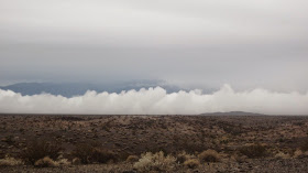 |
| fog storm's a comin |
 |
| birdcage primrose |
 |
| the great thing about a rainstorm, is that all tracks are fresh the next morning. these are ant trails |
 |
| first flowing water in a month on the trail. the mighty Amargosa River |
 |
| Tamarisk and Mesquite in the Amargosa Canyon |
 |
| rocks of every color |
 |
| subtle rainbow |
 |
| China Ranch date farm was a welcome oasis |
 |
| the first and only "town" of the trip is Tecopa, with the festive Death Valley Brewing Company lighting up the night. |
 |
| I thought so hard about beer and burgers over the last few days that they manifested! |
 |
| Then these guys were parked by the road. Gypsy time travelers |
 |
| good excuse for a zero-day! |
 |
| laundromat |
 |
| local hot springs known as the "mud hole" |
 |
| yep. |
 |
| downtown Tecopa |
 |
| live blacksmithing and storytelling |
 |
| good sign for a road-side hotspring |
 |
 |
| shade and tent-drying at the same time! |
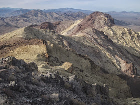 |
| Death Valley NP boundary |
 |
| metal canisters are handy for caching food |
 |
| the full moon brought us a visit from the legendary Jeff Larson |
 |
| Jeff scouts the brutal terrain we took him through. He was tough as nails to take on that section trail-fresh |
 |
| detailed navigation on a large scale map is always "fun" |
 |
| Alex's blackberry wine "Yeti's Reserve," was a sweet reward to our first vista of Death Valley and Telescope Peak |
 |
| straight up glampin' |
 |
| the final saddle above Sheep Canyon |
 |
| that's a lot of inner thigh |
 |
| makes for a hearty stew |
 |
| recent rains saw tiny green sprouts pushing up everywhere |
 |
| Death Valley!!!! |
 |
| hey guys i found the cache! |
 |
 |
| crossing Badwater when it's wet and muddy is surreal. The mud and alkali take on every kind of shape and texture |
 |
| sometimes it can be very slow going |
 |
| especially when the next 40 miles are along the valley floor |
 |
| we sought out gravel as much as possible to ease the mud walking |
 |
| WHO LIVES IN THERE???? |
 |
| STORM'S A COMIN!!! and nary a shrub for shelter |
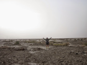 |
| a wall of rain approaches, blocking out 7000' peaks immediately behind |
 |
| and the mudwalking continues... on and on... |
 |
| i thought we came to the driest, hottest place in north america to avoid this crap! |
 |
| crystals of so many formations that the mind could never imagine, some as high as 2 feet, cover the landscape |
 |
| and then a cold norther swept it away, delivering several feet of snow to the higher peaks. shade was once again required |
 |
| after hundreds of miles without a cell signal, it was time to call home from the lone gas station at stovepipe wells |
 |
| marble canyon narrows |
 |
| lemme just clear this outta the way |
 |
| Biscoff Cookie Spread! Say no more. |
 |
| we found the ancient equivalent of a Denny's placemat |
 |
| a recent flash flood left a food of mud on the canyon floor, and a water line 4 feet high. |
 |
| you can see where a second, smaller flood event laid a narrower swath of mud on top of the first layer. it cracks as it dries. then water has carved a creekbed down the middle |
 |
| diggin up another cache |
 |
| old seabed |
 |
| Hidden Valley playa |
 |
| each rock pushes up a pile of mud in front of it as it goes along |
 |
| unfortunately, many of the rocks have been stolen, leaving behind these lonely tracks in the mud |
 |
| USE YOUR ARMS, LADDY! USE YER ARMS!!!! |
 |
| desert pavement |
 |
| time for dead reckoning in the fog |
 |
| black and white volcanic debris makes an interesting contrast |
 |
| all the sun we saw for several days |
 |
| Eureka Dunes |
 |
| Raven tracks |
 |
| toxic waste dump... an abandoned open-pit sulfur mine |
 |
| i went down into the mine to check it out and about 100 yards in only found one set of tracks. mountain lion. going in... that was a good time to mosey |
 |
| if you've done much desert trekking, you know that mylar balloons are almost the only modern litter |
 |
| cut a hole and put your insole inside it, then stuff it into the shoe |
 |
| waterproof shoe liners for the snow |
 |
| high elevation was a winter wonderland |
 |
| ammo can poking out of the snow on Last Chance Mountain |
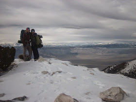 |
| Atop Last Chance Mountain, our goal, more than 500 miles and 6 weeks from Salton Sea |
 |
| looking at the Inyos |
 |
| glad to have waterproof sneakers now |
 |
| dropping back down into the snowless Cucomungo Canyon and a dirt road out to the highway |
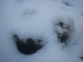 |
| Wintertime desert hazard... snow-covered cacti |
 |
| just putting some ornaments on the tree... |
 |
| plastic bags! perfect when your boots are soaked and you want to leave the tent to pee |
 |
| just another few miles of snowy trudging to top it off |
 |
| thanks to the SPOT!, Sherman's folks picked us up at the highway |
 |
| we swung by the ghost town of Rhyolite to check out the open air art museum |
 |
| the best rendition of "the last supper" ever. |


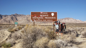






mylar gaiters. i likey
ReplyDeleteMateo, I may never see these places for myself, so thanks for sharing. All the best, queira vaya bien.
ReplyDeleteAidan
That looked like a fun trip to Palm Springs, Matt. I remember mountain biking there with a bunch of friends several years ago. We did the Palm Canyon Epic trails. Awesome!
ReplyDeleteGlad you had fun!
Cris
I don't understand... Who burried the caches for you to dig up?
ReplyDelete
ReplyDeleteExcellent article. I will be dealing with many of these issues as well.. outlook 365 sign in
They can even assess your organization plan and look the company's projected earnings based in your goals. canada mortgage calculator We're here to foster long-term relationships that last throughout your entire real estate property life, making your dreams for mortgage financial freedom our reality. mortgage payment calculator canada
ReplyDeleteGreat reading thhis
ReplyDelete